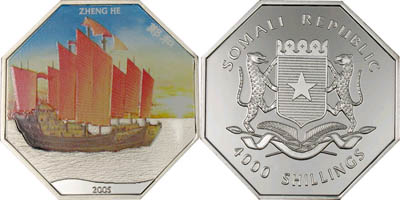
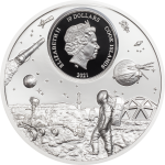
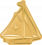
Somalia – 2005 – 4000 Shillings – KMnew Zeng He Boat silver (PROOF)
Contact for price; but do join the waitlist (click below) to be informed!
Description
In July 2005, China will celebrate and commemorate the 600th Anniversary of the maiden voyage in
1405 of their famous Admiral, Zheng He.
China has a very old sea-faring tradition. Chinese ships had sailed to both the Indian and Australian
sub-continents as early as the Han Dynasty (205 BC – 221 AD). Chinese sailors had an important
invention to help them – the Compass – or the ?south-pointing spoon?.
In the 1930?s, a stone pillar was discovered in a town in Fujian province. It held an inscription that
described the seven amazing voyages of a Chinese Admiral named, Zheng He. The 3rd Ming
Emperor, Yung Lo (1403 – 1424) had ordered him to sail to ?countries beyond the horizon ? all the
way to the end of the world?.
In July 1405 under the command of Zheng He the fleet took off :
– 28,000 sailors and navigators, including astronomers, doctors, scribes, shipwrights
concubines, cooks, artisans and peasants .
– 60 ?Treasure Junks? 140 m long, 60 m wide, equipped with 9 masts, stern helm
– under deck, 16 water-tight compartments, for rice, trading cargo and livestock, or filled with
water for live fish;
– on deck: vegetable plantations,
Each ship was a ?floating? village, prepared for long distance travelling over the Oceans by over 300
smaller Junks.
With his seven voyages until 1423 he made history ? crossing the Indian Ocean to Somalia bringing
back to China, a famous giraffe for the Emperors zoo.
He sailed around the tip of Africa into the Atlantic, up the Congo river (Matadi waterfall stele), to the
Caribbean, South America, North America and to the Arctic, – discovered the passage from the Atlantic
into the Pacific (Cape Horn), Antarctica, New Zealand and Australia.
Navigating by the stars, the South Cross, the Canopus and the Polaris, and calculating the meridians,
very reliable maps were drawn by his cartographer Sanbao. These maps found their way to Venice
and later to the Portuguese King, Henry ?The Navigator? .
He treated them as a state secret and used them as the basis for his discoveries undertaken years
later around Africa and to find the way to India. Columbus ?.. to find India – go west?? was also aware
of the details of these maps as well as Magellan ?..there is a passage to China!?
Drastic political changes in China banned the voyages of the treasure ships due to the considerable
expenses incurred by the reparations and expansion of the Great Wall to repel the invading Mongol
tribes. Because these voyages did not lead to any significant benefits or trade with the under-developed
Barbarian tribes across the oceans, in1426, the Emperor Hsüan ? te ordered the destruction of all
large ships, shipyards, drawings and all official documentation about these voyages.
All trading links with overseas locations were severed and also the cutting of wood for ship-building
was forbidden. Only the basics of the maps survived as privately kept records for future examination.
Zheng He died in 1433.

